
A series of powerful earthquakes and aftershocks left much of Southern California trembling over the long holiday weekend. The most powerful of the quakes, a magnitude 7.1, struck on July 5th, and it shared its epicenter with a slightly less intense magnitude 6.4 quake from the day prior.
Now, using a particularly powerful high-tech instrument in Earth orbit, NASA’s Jet Propulsion Laboratory is sharing a glimpse of the scars the quakes left behind. The ALOS-2 satellite provided scientists with radar data of the affected area which was then compared to readings from the same area a year prior, giving us an idea of how the landscape has changed as a result of the recent rumbles.
As NASA’s Jet Propulsion Laboratory explains in a new blog post, the colors we see on the map represent changes in ground level when compared with scans from the previous year. One full color cycle — so from yellow to yellow, for example — represents 4.8 inches of displacement.
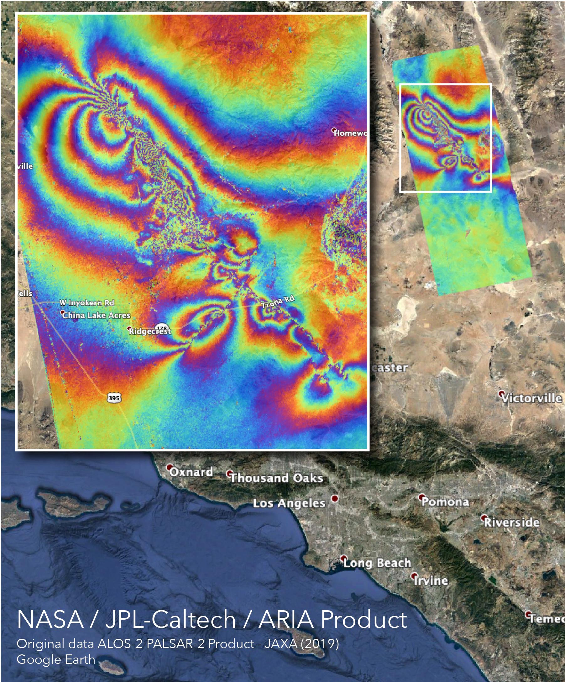
“The linear features that cut the color fringes in the southeast indicate likely locations of surface rupture caused by the earthquakes, and the ‘noisy’ areas in the northwest may indicate locations where the ground surface was disturbed by them,” JPL explains.
As JPL notes, the United States Geological Survey has detected upwards of 1,000 aftershocks since the July 5th earthquake. That isn’t necessarily unusual in the wake of a large quake, especially for a state that has so many tiny earthquakes that it tallies a new one every three minutes or so.
These recent rumbles definitely weren’t “The Big One” that many Californians fear is coming soon, but they are a reminder that a truly catastrophic quake could strike when we least expect it.


