
One of Europe’s newest weather satellites, the Meteosat Third Generation Imager, is finally getting to work. The satellite, which is also known as MTG-I1 has taken its first images of Earth, and they are absolutely mind-blowing.
The images, which you’ll find embedded in the article below, showcase the clouds and oceans of Earth, as well as the continents found strewn across our planet. The photos are beautiful and will hopefully help us learn more about weather patterns and other phenomena.
Space agencies around the globe have been trying to study the weather for years, with NASA even using a CubeSat several years ago. With newer satellites like the MTG-I1, though, the goals that scientists have could finally be obtainable.
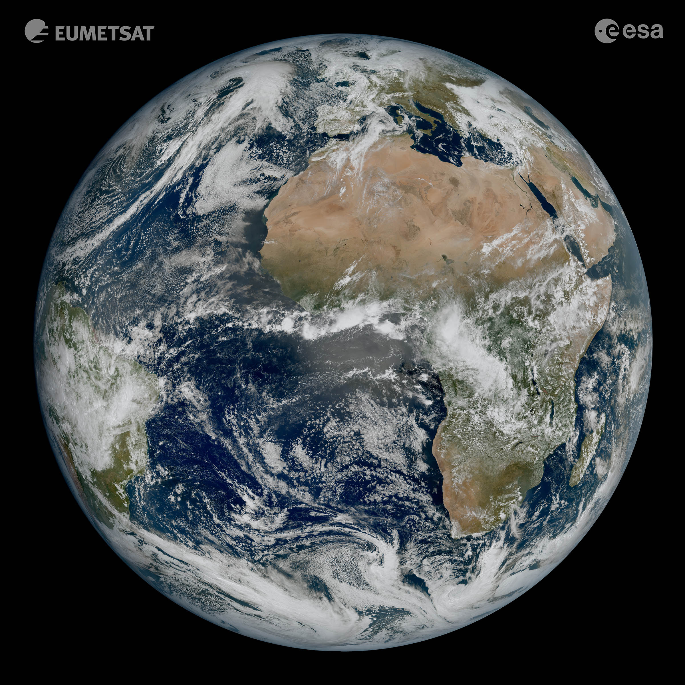
These first images from MTG-I1 focused on the Atlantic, Europe, and Austraila, providing tons of remarkable detail in the clouds and other global conditions. The image itself was captured by MTG-I1’s Flexible Combined Imager back in March. The satellite originally launched in December of 2022, so it has taken a few months to get everything set up and operational.
The use of improved satellites like the MTG-I1 will no doubt provide us with plenty of images of Earth, all of which can give us a deeper insight into our planet and the various conditions that affect it. The quality of the images captured by MTG-I1 is exceptional, too, and that quality even shows in time-lapses of weather conditions, which you can see in action below.

The level of detail found in these first images from MTG-I1 is a clear example of just how important European cooperation in space is, according to the ESA’s Director of Earth Observation Programmes, Simonetta Cheli. Cheli says this kind of detail was unobtainable before MTG-I1, so the satellite is literally changing the perspective at which we can study European weather.
The images that MTG-I1 can capture are also capable of capturing great detail in cloud structures at high latitudes, which the ESA says will help make it easier for weather forecasts to monitor the evolution of severe weather in the region.


