
Google Maps is one of the best navigation services out there, thanks to the various features Google has added to it over the year. And Google Earth is equally interesting, providing updated satellite imagery for regions all around the world… except for one piece of land in Nevada, which Google Earth stopped mapping for eight years, according to a new report. And nobody seems to know why.
From 2008 to 2016, Google did not update the imagery for “a series of dry lake beds in Southwestern Nevada located in the Tonopah Test Range,” according to a Motherboard report. Google Earth later posted images from 2014 and 2015, but that still leaves a gap of 6 years during which satellite imagery for the area is missing.
What’s so important about the Tonopah Test Range?
Tonopah is a subsection of the Nellis Test and Training Range, which is jointly operated by the Department of Energy and Air Force.
What about the Nellis Complex?
The Nellis Complex contains the drone pilot HQ Creech Air Force Base, the site of extensive nuclear detonations formerly known as the Nevada Proving Grounds, and what is colloquially referred to as Area 51. The F-117A Nighthawk stealth fighter, experimental unpersoned aerial vehicles, and, most recently, the delivery vehicle of the much-thunkpieced B61-12, a ‘steerable,’ variable yield nuclear bomb, have been tested there. This made Tonopah a deeply unlikely place to be coincidentally left off a map anyone with access to Google could survey.
The highly detailed report, which is worth a read, mentions that the US government has means to censor satellite imagery if it deems it necessary, but it’s unclear if the government did so or not.
The researchers obtained eight images of the region from Apollo Mapping, from 2009 to 2014, which could have been used for Earth imagery of the area. The report also notes that, according to recent data, Google Earth is able to cover the entire US once every three years, except for this area in Nevada:
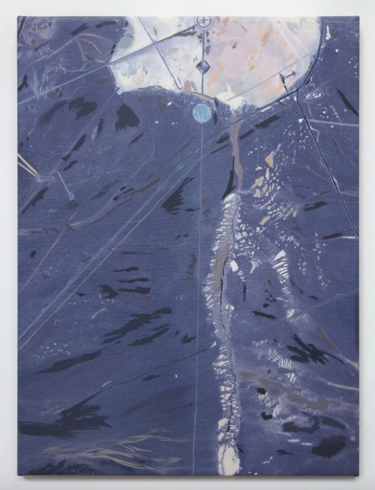
What’s interesting is that the researchers bought an image of the area under a grant, paying $1,984.50 to Apollo for it, with the intention of reselling it for $1. But it turns out that they only leased the image, which meant they couldn’t sell it or even post it online. So what they did instead was share the painting above, based on the image they bought.
The researchers will show this image on Thursday, at 6:00 PM, at Eyebeam, at 199 Cook Street in Brooklyn, which is where a whole new slew of conspiracy theories will likely begin.


