See Where Your Home Was At The Time Of The Dinosaurs Using This Interactive Map
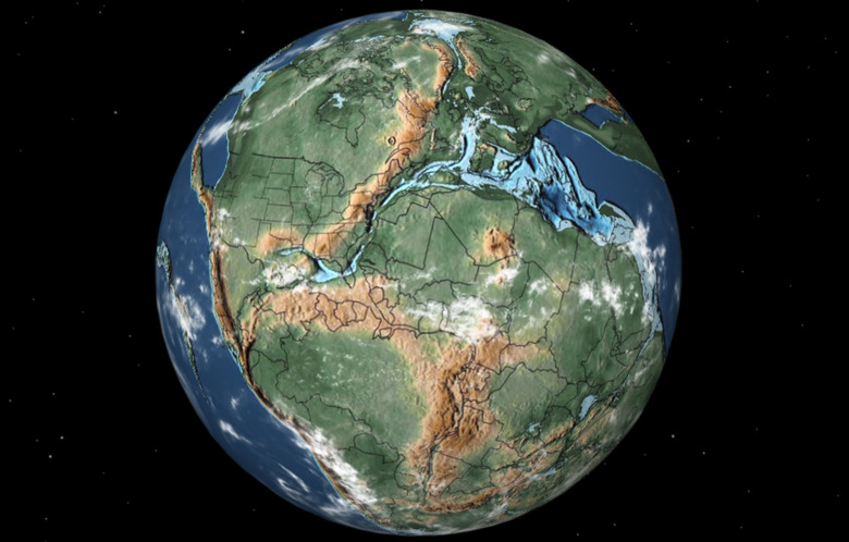
A new website lets users pinpoint their home city and then see where it was located during the time of the dinosaurs, as well as during other periods of time across ancient Earth. Additionally, the map also showcases how the continents have shifted since the time of ancient Earth and even how ice covered the land throughout history.
The map was created using data and research from the Northern Arizona University, Ian Webster, the former Google engineer behind the project, says. The website allows you to jump through different times in history, including when the dinosaurs roamed the Earth, when they went extinct, and even when the first flowers or reptiles roamed the planet.
It's an in-depth piece of software that really goes deep in showcasing how ancient Earth evolved and changed to become the planet that we know and see today, and even how ancient life evolved. There are also several options to showcase the clouds, make them brighter, and even show the equator for an easier way to see the changes and how massive they were as the continents and landmasses shifted.

Using the map, you can easily see where states and countries are located, including the United Kingdom, the United States, Africa, Europe, Australia, Russia, China, and more. It's honestly really intriguing to see just how much the Earth has changed since those ancient times, and it really puts everything into perspective.
The website's featured globe is completely rotatable, allowing you to spin it like a free-standing globe. It will also reveal which dinosaurs used to live nearby in the area that you searched, including showcasing the types of fossils that can still be found within the area. If you've ever wondered where your home was during those ancient times on Earth, this map can help give you some answers.
The map is built on top of another map made by geologist and paleogeographer Christopher Scotese, which helps visualize geological models. This all comes together nicely, creating an easy-to-use tool.