Scientists Create Most Detailed Map Of Antarctica Ever
Chances are you make it through most days without sparing a thought for Antarctica. At just over 5.4 million square miles, it's a massive chunk of land that is nearly twice the size of Australia and dwarfs the continental United States. It's also covered in ice, which makes it a lot less appealing as a potential vacation destination.
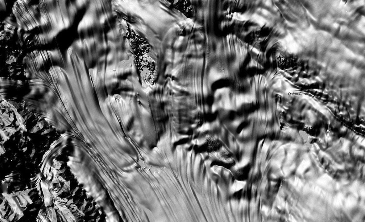
Still, it's of great interest to scientists and researchers, and a new mapping effort has yielded the most stunning, high-resolution glimpse of the continent ever.
The new map, named the Reference Elevation Model of Antartica (or REMA for short), was created by researchers at Ohio State University led by professor Ian Howat. His desire to create the incredibly detailed map was the simple fact that, up until now, maps of Antarctica were just plain bad.

"Up until now, we've had a better map of Mars than we've had of Antarctica," Howat, a professor of Earth sciences and director of the Byrd Polar and Climate Research Center, said in a statement. "Now it is the best-mapped continent."
To construct the map, Howat and his team had to sift through an immense amount of data that was constantly being gathered by satellites cruising over the continent. To aid in piecing together the various high-resolution images, the researchers built a tool that matched the images up, overlapping edges and aligning it to be as accurate as possible.
The end result is a map that is not only incredibly sharp, but also extremely large in terms of file size. The full map's size actually tops 150 terabytes. Yes, you read that correctly. Assuming the smartphone in your pocket holds around 64 GB of data, you'd need over 2,300 of them to hold the amount of data in this one map image. Yikes.
But why bother to create such a detailed map of a place that is essentially just a big block of ice? Antartica is a great indicator of the health of the climate, and by measuring changes in the ice in the region scientists can learn a lot about where the planet is heading.
"At this resolution, you can see almost everything," Howat explains. "We can actually see variations in the snow in some places. We will be able to measure changes in the surface of the continent over time. We will see changes in snow cover, changes in the motion of ice, we will be able to monitor river discharge, flooding and volcanoes. We will be able to see the thinning of glaciers."