Google's Creepiest Maps Feature Can Help Stop The Coronavirus
- Google released a new mapping resource that can help slow the spread of the novel coronavirus pandemic.
- The new Community Mobile Reports show anonymized location data that can help authorities understand whether social distancing measures are being taken.
- Google collects the data from phones just like it does for Google Maps, but it says it won't reveal any identifying info to authorities.
- Visit BGR's homepage for more stories.
Google came under fire a few years ago for collecting user data from phones even when users thought that wasn't happening. Since then, Google took several steps to ensure that users have more control over their location data. You can delete your data from Google's servers manually or automatically and even use Google Maps anonymously. Android 10 also guards your location data better than ever. Yet Google still can identify you in a crowd, as we've seen just recently when a biker became the prime suspect in a burglary because of his training-related location data. On the other hand, the massive amount of location data that Google collects helps it improve popular services like Google Maps that depend on location information.
But if there ever was a time when Google's location tracking abilities could come in handy, it's now. The novel coronavirus pandemic can only be fought with strict social distancing measures. Flattening the curve is the main goal of most governments around the world, and that can only be done if most of the population complies with directives to stay at home. And Google is now ready to harness its location data to alert local governments if their social distancing orders are not being followed.
Google a few weeks ago launched its coronavirus tracking website, a resource it didn't know it was building until Trump talked about it on TV. The site itself offers basic information and quick links to regional resources that can help those in need. But Google also added COVID-19 resources to YouTube, News, and Maps in an effort to provide additional information points about the new virus.
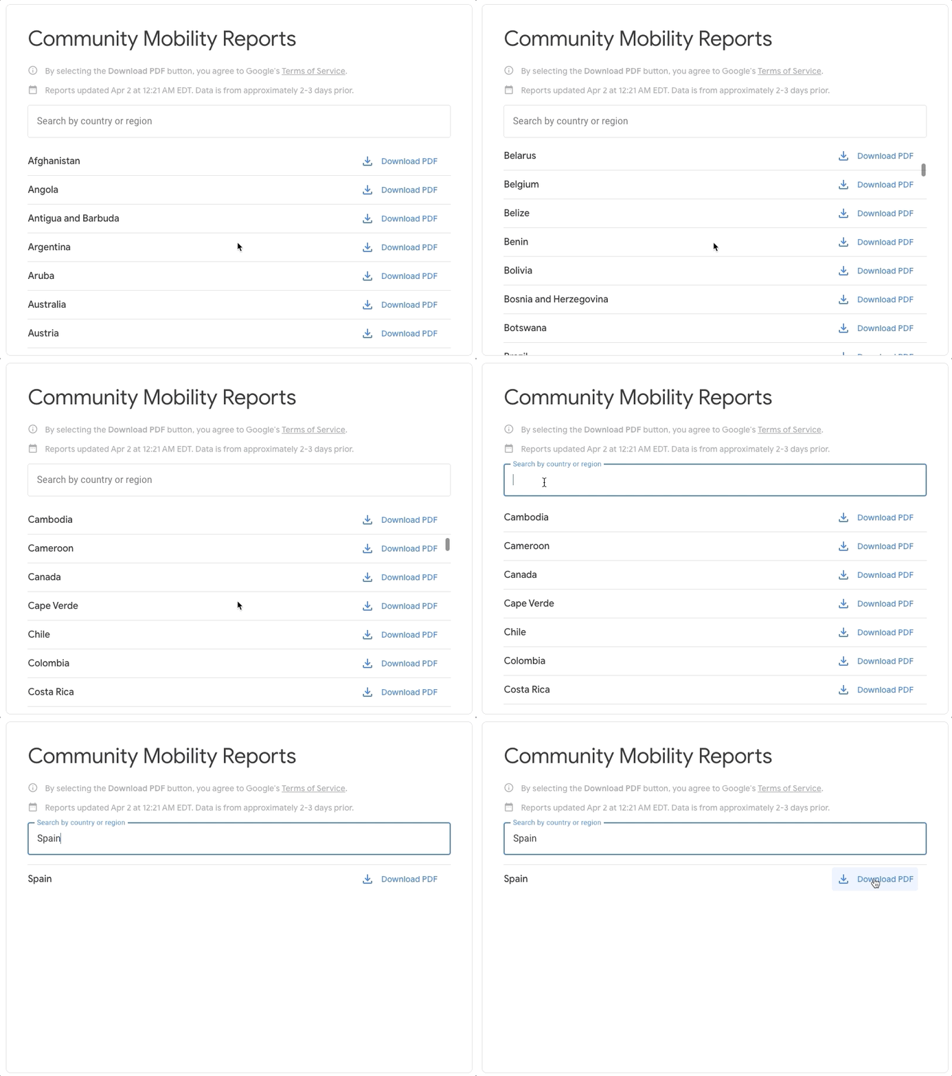
The company on Tuesday launched its social distancing website: COVID-19 Community Mobility Reports. By accessing this link, you can download social distancing situation reports for any region that Google covers. The Community Mobility Reports use "aggregated, anonymized data showing how busy certain types of places are," Google said in a blog post.
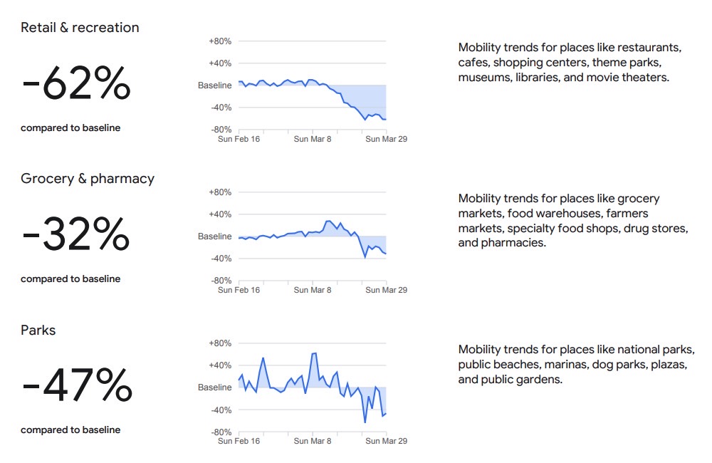
The data in these reports will show how traffic has changed following lockdowns and quarantines, with Google focusing on certain types of locations including "retail and recreation, groceries and pharmacies, parks, transit stations, workplaces, and residential."
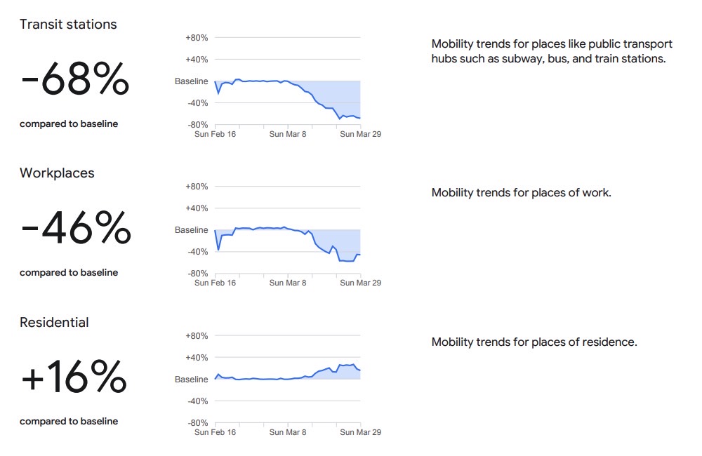
The screenshots in this post come from Google's report for New York, the US state that has been hit the hardest so far by the novel coronavirus. New York accounted for more than 93,000 patients at the time of this writing, out of America's more than 245,000 cases. The reports aren't just available for the US, as they cover various other countries experiencing COVID-19 outbreaks right now.
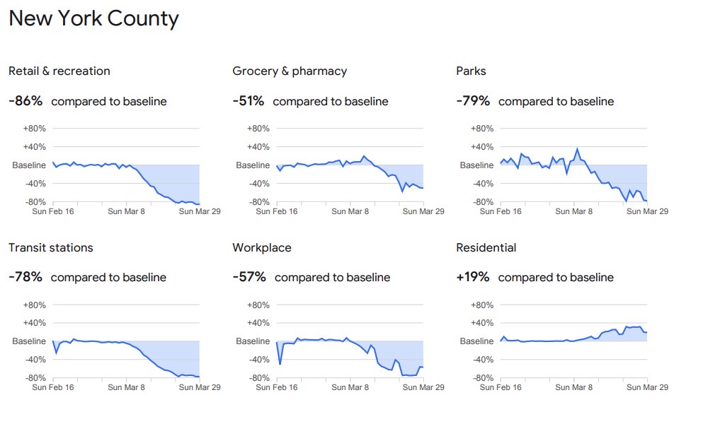
Google will display aggregated data over several weeks, with the most recent information covering the last 48-to-72 hours. The resource can be used by officials to determine whether social distancing measures work and whether additional steps need to be taken to reduce the risk of COVID-19 transmission:
For example, this information could help officials understand changes in essential trips that can shape recommendations on business hours or inform delivery service offerings. Similarly, persistent visits to transportation hubs might indicate the need to add additional buses or trains in order to allow people who need to travel room to spread out for social distancing.
The reports will have privacy protection in place and won't include actual counts, according to Google. The data will come from people who have Location History enabled on their phones and will include artificial noise on top.
