This Is The Most Important Google Maps Feature During The Coronavirus Crisis

- A Google Maps feature that allows anyone to create custom maps of their local region has seen a surge in usage this year.
- Some authorities and regular users rely on the My Maps functionality to create custom maps that can be helpful during the novel coronavirus pandemic.
- The feature is available to any Google Maps user to use for free.
- Visit BGR's homepage for more stories.
Google Maps is one of the various tools you should have in your arsenal of anti-coronavirus apps. You might not be driving as much as you were before this modern plague, but Google's app can still be very helpful. The Maps app now includes COVID-19 warnings when you search for doctors, and it highlights restaurants that deliver — the app can even be used to order food from participating restaurants. On top of that, Google Maps lets business owners update their listings to make sure their customers have the most accurate information about their shops.
These are features that Google added or upgraded in Maps in the past few weeks, but it's not just Google that's using Maps to help users during the pandemic. Maps users can create their own custom Google Maps for all sorts of instances, and it turns out that plenty of people have been using this functionality to come up with relevant maps that can help people during the health crisis.
The tool is called My Maps, and Google said in a blog post on Wednesday that it witnessed a surge in My Maps usage in the past few months. "From December 2019 to April 2020, we saw nearly a billion more My Maps creations, edits, and views compared to the same time period last year, growing from 2 billion to nearly 3 billion," Google's Chris Herwig explained.
They're not all coronavirus-related maps, but Google does offer plenty of handy examples of custom Google Maps created to handle the pandemic. Some interesting use cases follow below.
The Wyoming Department of Family Services made a map to guide essential personnel to childcare facilities: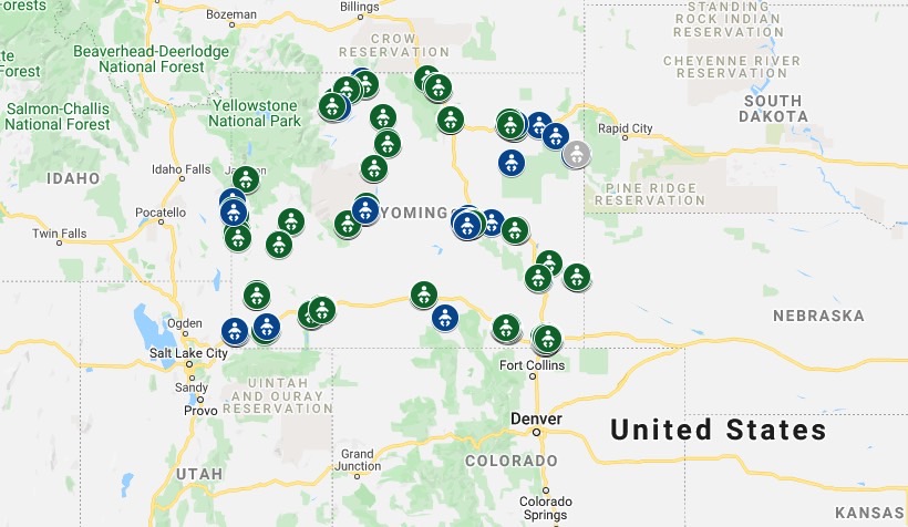 Massachusetts' Child Nutrition Outreach Program used the My Maps feature to help families find sites serving meals to children and teens during school closures:
 Mississippi librarians made a map of parking lot Wi-Fi access points:
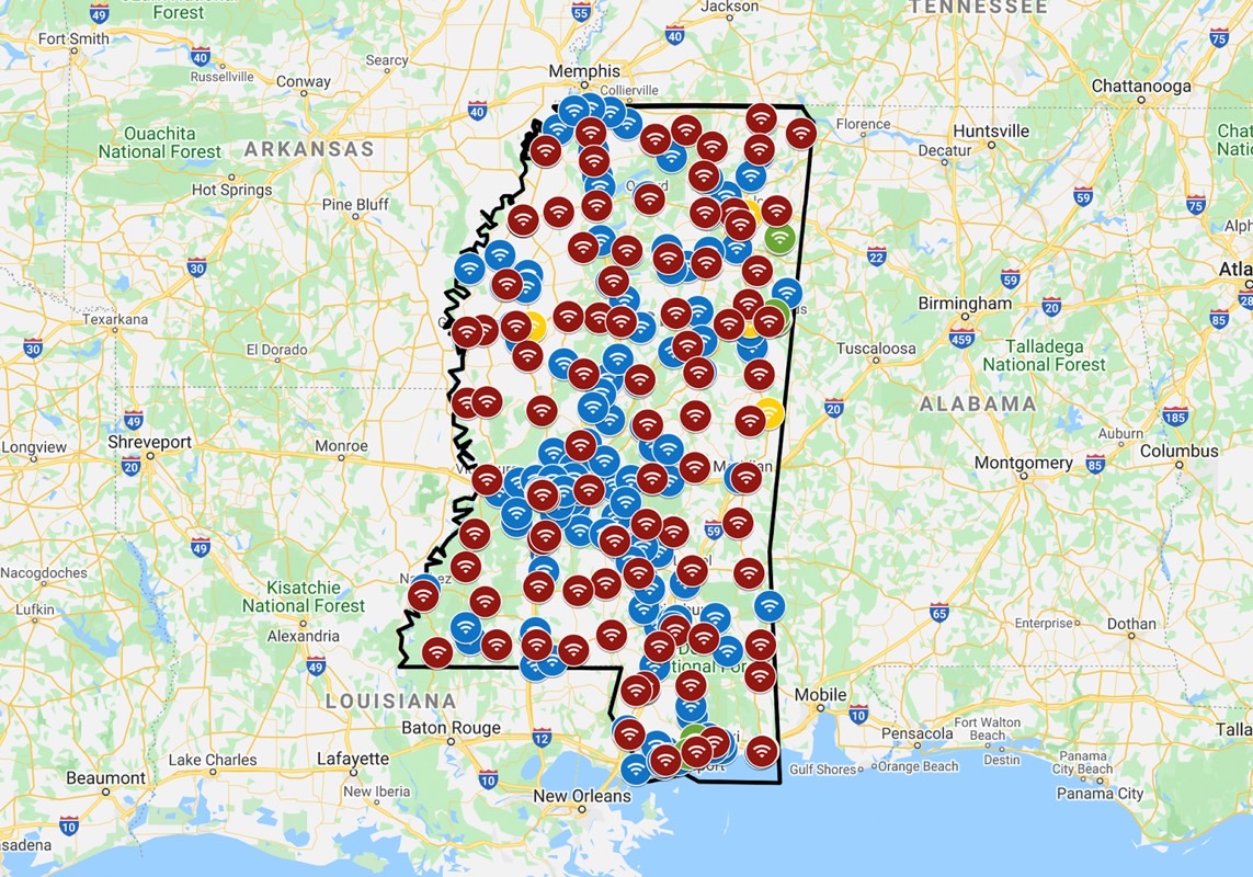 The Philippines' Department of Transportation used My Maps to create a map for transportation services for COVID-19 medical front-liners:
![]() Taiwan's CDC relied on My Maps to visualize the traces of confirmed patients on their contact tracing website:
Taiwan's CDC relied on My Maps to visualize the traces of confirmed patients on their contact tracing website: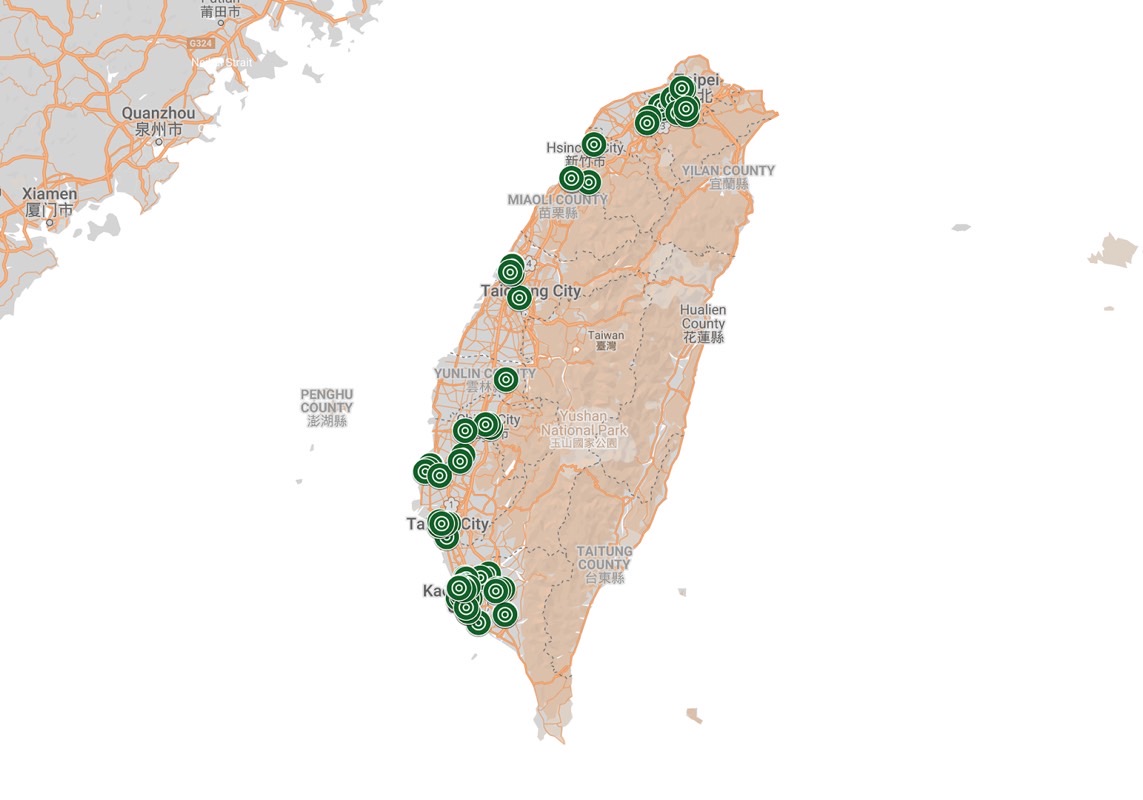 Australia's New South Wales Ministry of Health mapped all the public COVID-19 clinics:
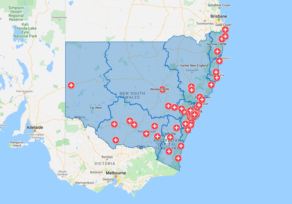 A citizen in the Maldives made a local map for shops, pharmacies, and food businesses by zone:
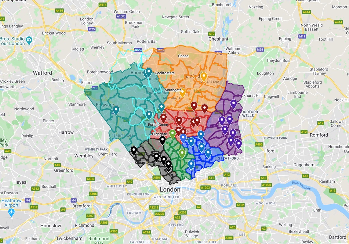
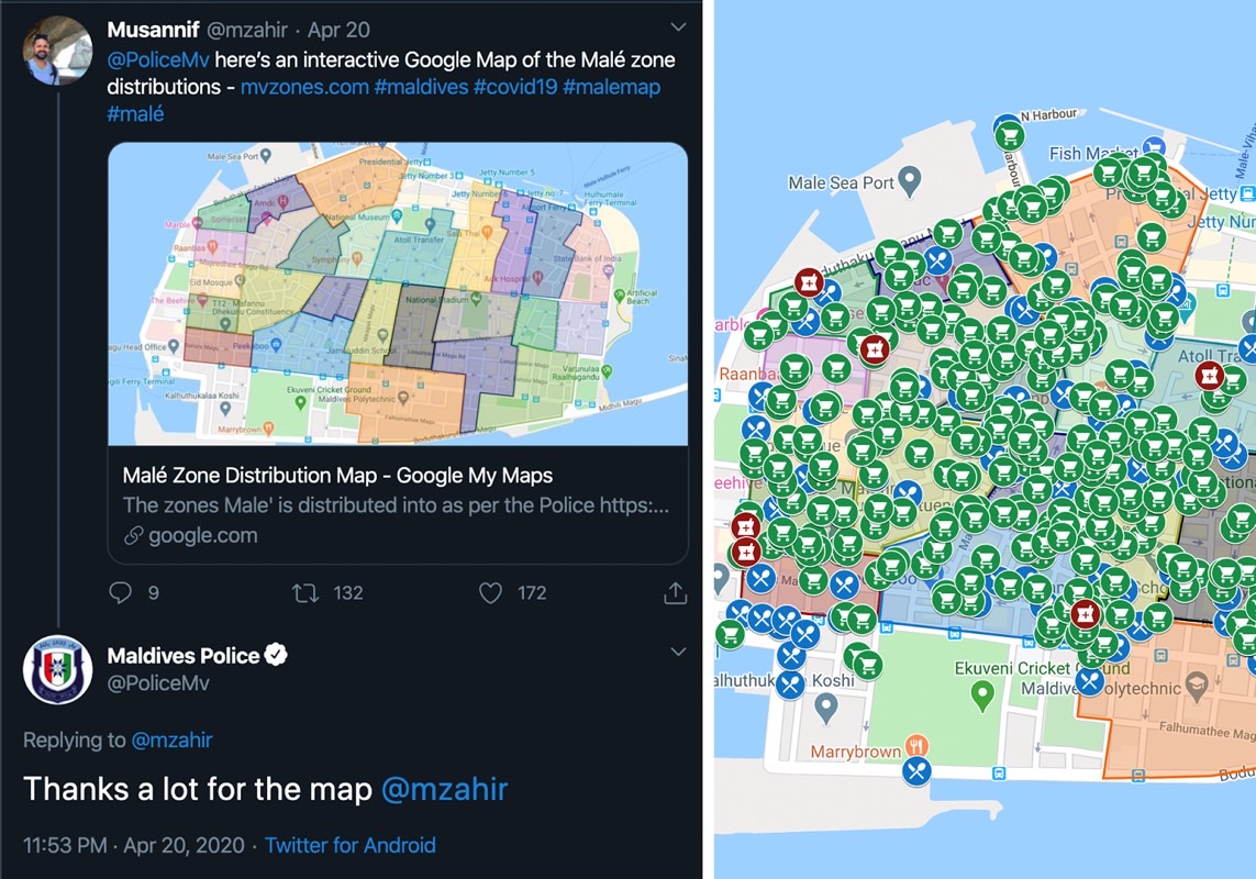 A freelance developer from London created a My Map that contains links and contact details for North London council boroughs and wards with links and contact details for coronavirus support services, charity organizations, and mutual health groups: